
Fastpacking the Hardrock 100 course
It lives up to its 'Wild and Tough' motto and is one of the hardest things that I've ever done!

In July 2022, my friend Richie and I decided to fastpack the Hardrock 100 mile course in the San Juan Mountains of Southwestern Colorado. We learned that running the course in this manner (i.e. self supported and not part of the actual race) is called running Soft Rock. I’m guessing the soft refers to the fact that you’re not racing world class athletes and can take your time to ‘smell the flowers’. Regardless of what you call it, I promise you that there’s nothing soft about it - it is unquestionably one of the hardest things that I’ve ever done! The Hardrock Endurance Run is a 102+ mile ultramarathon through the San Juan Mountains with 33,000+ feet of elevation gain and attracts some of the best runners in the world each year. Similar to other high profile ultras such as Western States and UTMB, Hardrock is very difficult to get into as there typically are about 2,800 applicants vying for only 150 spots in the race.
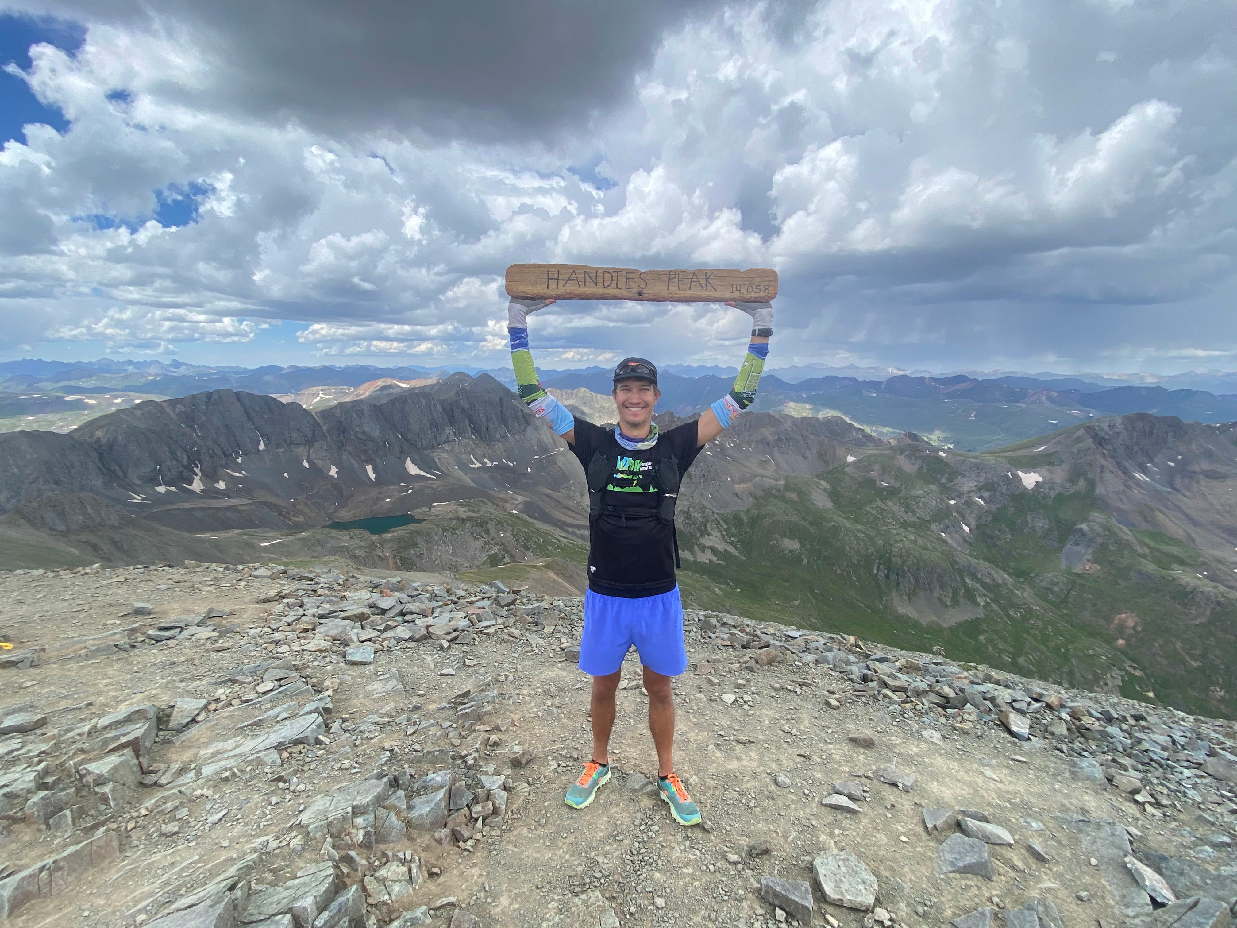
Handies Peak is one of Colorado’s many 14ers and is the highest point on the Hardrock course.
Why should you do it? As you might imagine, running Soft Rock requires excellent stamina, fitness and mental toughness. It is an amazingly beautiful and rugged course and if you decide to give it a go, it may be one of the hardest and most rewarding things that you ever do. Running Soft Rock, as opposed to racing the Hardrock 100, also provides the opportunity to enjoy the scenery and the course more than the racers as you’ll be going slower and will also spend 2-3 nights camping in the backcountry. Furthermore, if you’ve been trying to get into the race for many years and are tired of not getting in, why not just head out on your own and enjoy the course without the pressures of racing an ultramarathon?
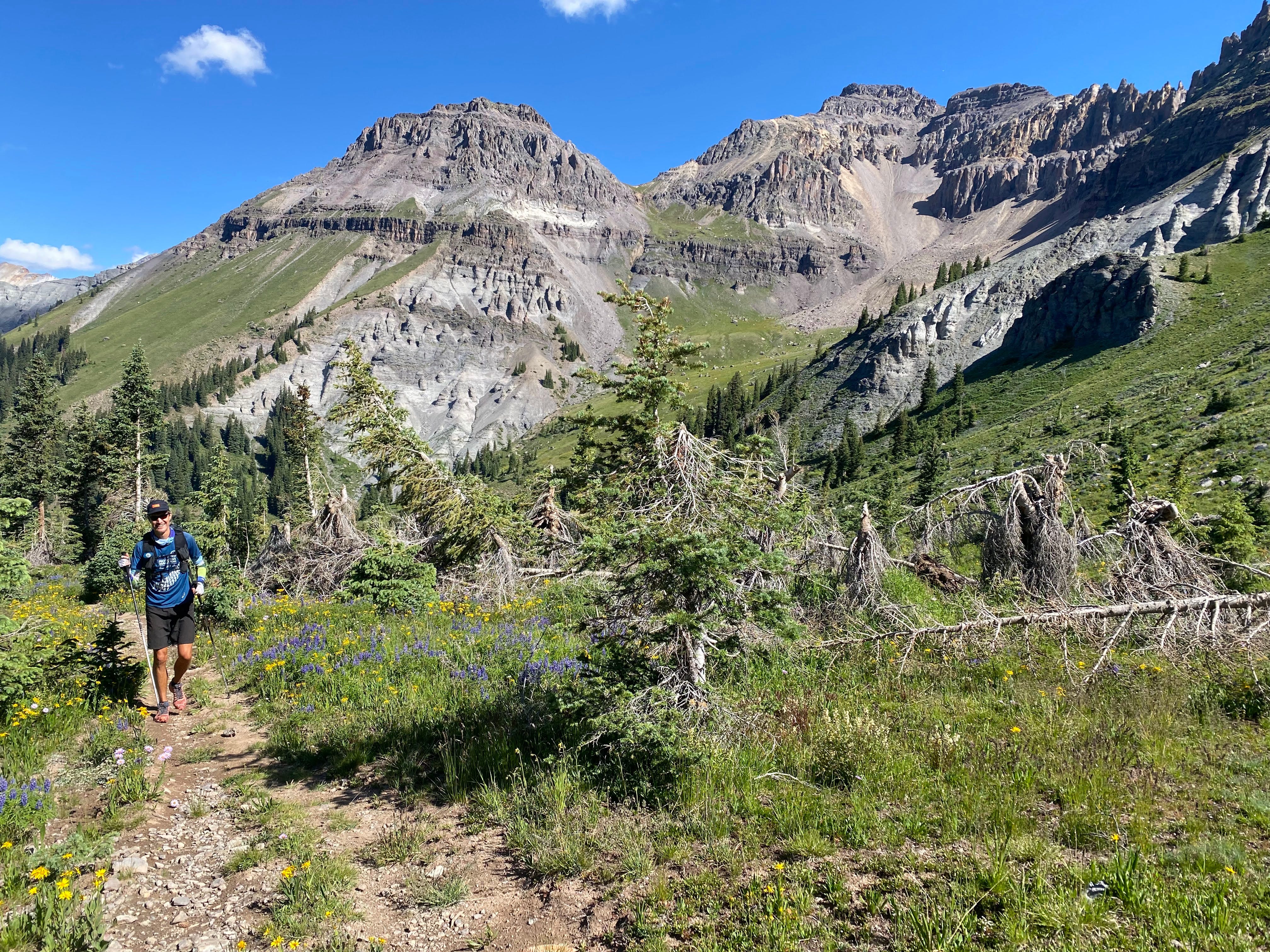
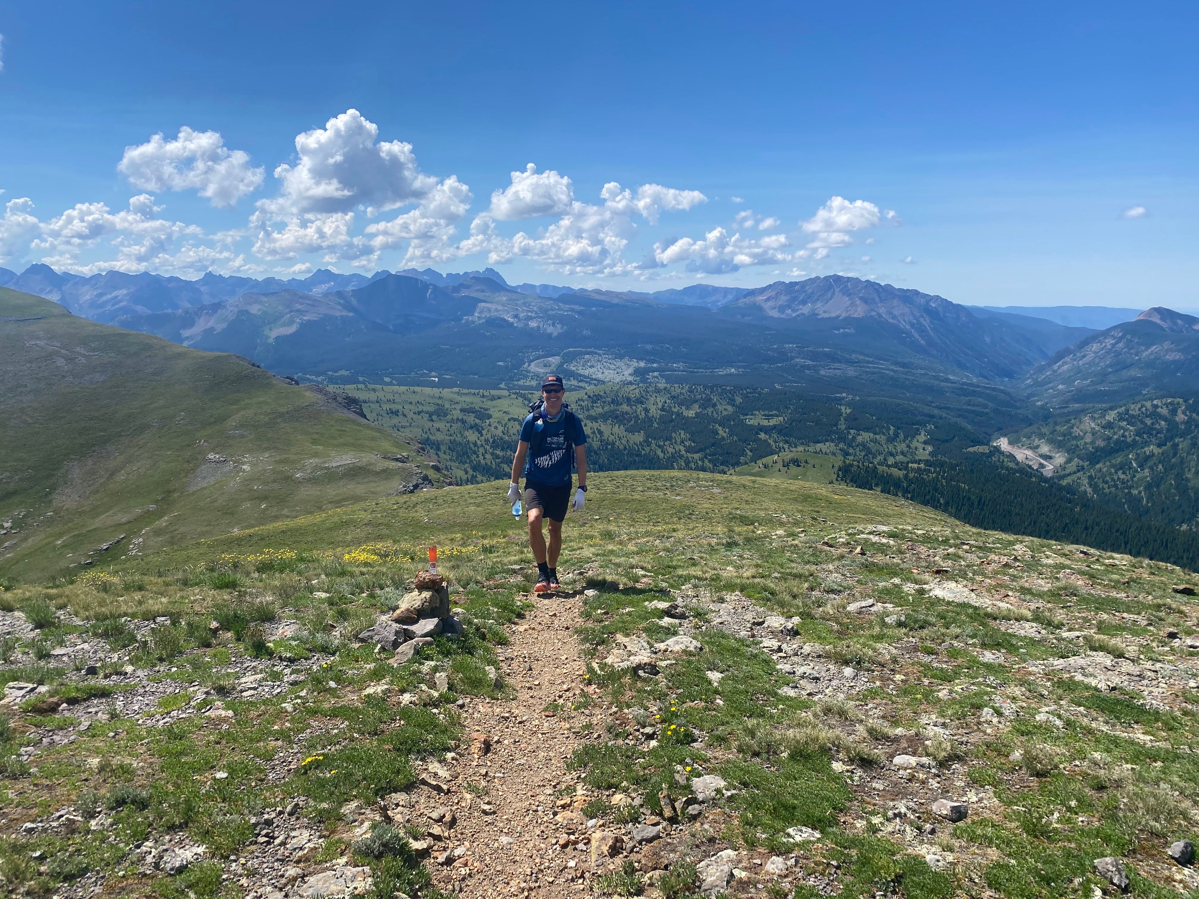
The scenery is second to none on the Hardrock course.
When should you do it? You can do this course anytime during the summer months but I highly recommend running Soft Rock the week before the Hardrock race (second Friday in July) as the course will be marked then. The course is fairly difficult to navigate on your own so having a marked course provides a significant advantage. I hiked through some sections of the course 2 days after the race was over and the course markers had already been removed by then. We ran Soft Rock the week before the 2022 race (July 15-16) and even with the course markings in place, we still managed to get lost at least 3-4 times.
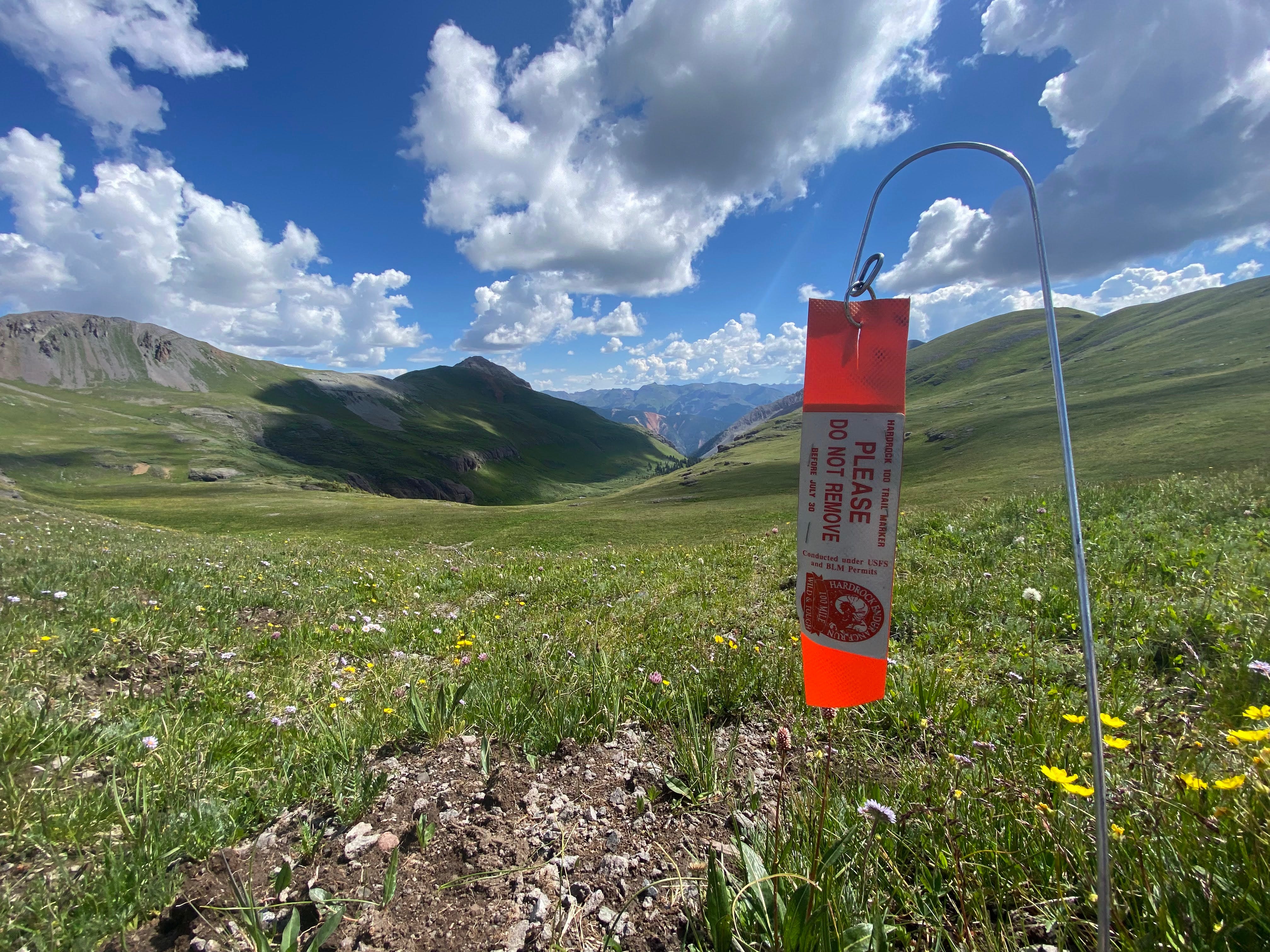
These orange Hardrock course markers are posted every 1/4 mile or so along the course the week before the race happens in July.
How should you prepare? Here are my recommendations for preparing for a Soft Rock run:
Training - do LOTS of it including as much elevation as possible. I must admit that I came in underprepared and I paid the price. I felt like I just couldn’t run so much of the terrain as it was ridiculously steep and I didn’t feel acclimated to the high elevation. The average elevation of the course is 11,000’! Richie took his training more seriously and definitely benefited as he was able to run at least ten percent more than I was.
Gear - trekking poles, running pack, sleeping quilt, tarp, water filter/bottles, headlamp, stove/pot, nutrition, lightweight rain shell, sleeping pad, food, etc. We also had a Garmin InReach Mini GPS and satellite communicator for emergencies as well as providing our partners with daily updates.
Test run - if you haven’t done overnight fastpacking trips before, I recommend doing at least an overnight test run with all of your gear to see how it all works so that you can make changes before heading out into the San Juans.
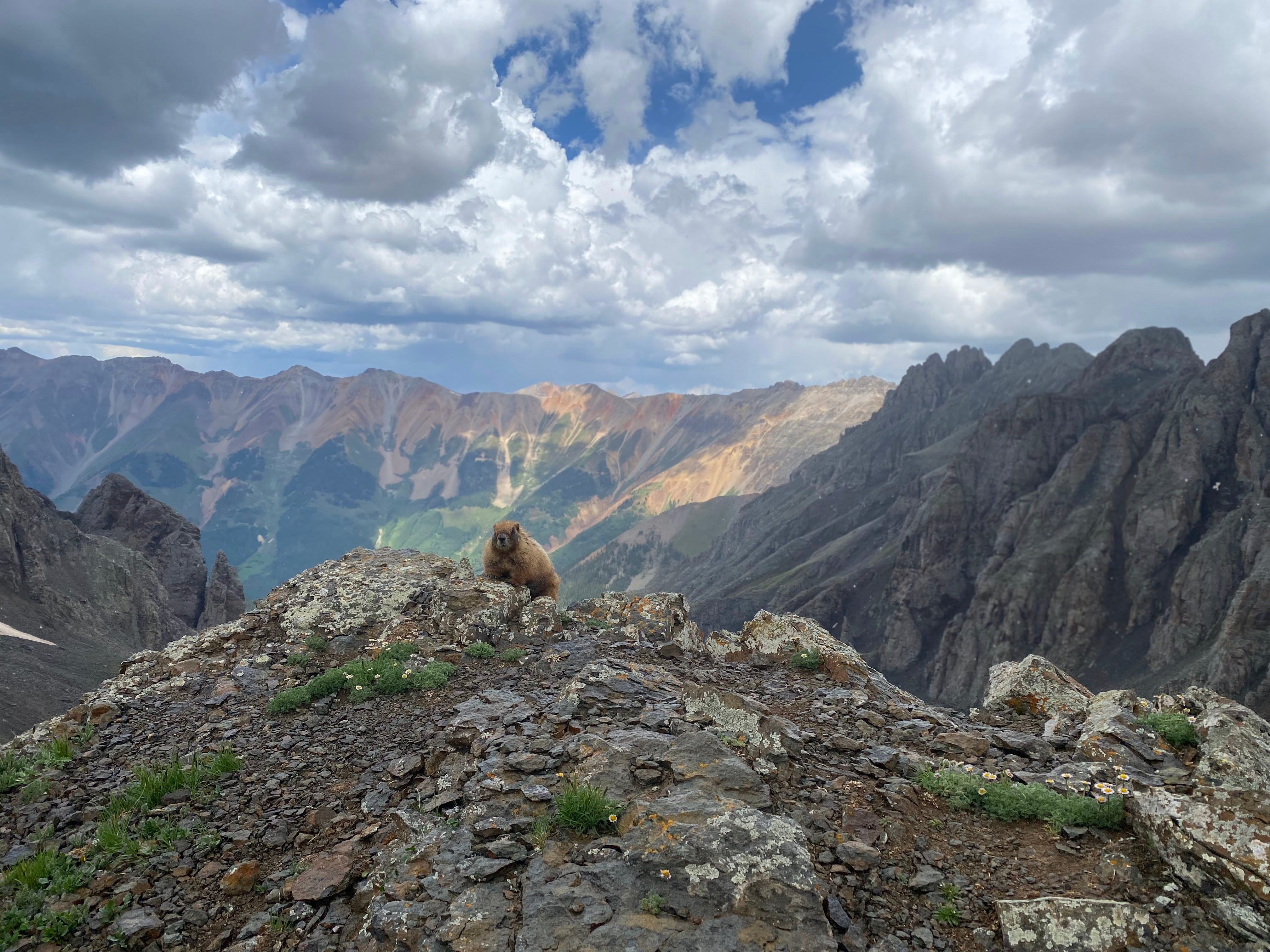
Marmots are not bashful and will wonder what you’re doing in their backyard.
Richie and I headed out on Tuesday morning from Silverton and decided that we would run the course in the clockwise direction since that was the direction that the race was being held that year. Some of the athletes had already started to roll into town so it was exciting to feel like we were part of the event even though we were doing it on our own. Initially, we were hoping that we could complete the course in 3 days but it ended up taking us 4 days. Following is a brief summary of each of our days:
Day #1 (28 miles, 10,000 feet of elevation gain, 12.5 hours) - Silverton to just before Telluride (Bear Creek Trailhead) - we generally felt pretty fresh and were blown away by the scenery on our first day, especially the climb that looks over Island Lake. 15 miles into the run, we got a little lost on the ridgeline near Vermilion Two Peak until we realized were just supposed to bomb down the scree field at the pass. There were three big climbs with the last two climbs topping out at just over 13,000 feet. We finished the day with a nice descent down towards Telluride and we camped just before hitting town right at the Bear Creek Trailhead. It wasn’t the greatest camping spot as we camped right next to the trail but we were tired and figured we’d be up early to start Day #2.
Day #2 (31 miles, 9,400 feet of elevation gain, 12 hours) - Telluride to Animas Fork Aid Station with resupply in Ouray - after breaking camp, we started the day by resupplying at a grocery store in Telluride before starting another 4,000 foot climb on our way over to Ouray. After making it over the pass (6+ miles into the run), we hit a fire road and had a nice gradual 10 mile descent all the way into Ouray. This was one of my favorite parts of the run as it was one of only a few sections where you could really just air it out and run at a decent pace. We met up with my wife in Ouray and resupplied for the rest of the adventure (thank you Ginny!). Heading out of Ouray, we had another big climb (5,000’ this time!) along Bear Creek on our way up to Engineer Pass. We finished the day with a few faster miles on a fire road on our way down to the Animas Fork Aid Station where we camped for the night. This was our best campsite of the trip as we camped amongst some trees which provided a welcome windbreak and were also very close to a pit toilet.
Day #3 (27 miles, 7,400 feet of elevation gain, 12 hours) - Animas Fork to near Maggie’s Gulch - after having a few good chats with the volunteers who were getting the aid station ready for race day, we got moving knowing that we had a big day ahead of us. Our first climb was the biggest of the entire trip to summit Handies Peak (elevation 14,058’). The view was unbelievable from the summit and after taking it all in, we started the long descent off the mountain. We ran a few fast miles on a fire road along Lake Fork before starting the final climb of the day up Cataract Gulch from Sherman campground. Our energy levels were lagging and it became evident that we would be spending one more night in the backcountry before making it back to Silverton. Fortunately we had brought enough food to spend one more night in the backcountry. As we were making our way up this valley at the end of the day, we came upon a massive herd of elk bugling to each other - it was a magical moment and surreal experience that we’ll never forget. We camped for the night under some pine trees without even using the tarp as we were so tired and it also didn’t seem like it was going to rain.
Day #4 (17 miles, 5,100 feet of elevation gain, 7 hours) - Maggie’s Gulch to Silverton - we got our earliest start of the trip (6am!) as we knew this would be our last day and wanted to make it into Silverton by midday. We had some fairly easy miles to start the day on our way down to Cunningham Creek. Our final climb up to Little Giant was a real slog but we knew it was all downhill to Silverton after that. We were quite tired but enjoyed a few relatively fast miles on our way into Silverton. We were overjoyed to make it back to Silverton and it was captivating to see the race in full swing - Kilian Jornet and Courtney Dauwalter were well on their way to winning the race and setting course records - 21:36:24 and 26:44:36 respectively.
It’s all smiles when there’s mountains for miles!
What else do you need to know for your Soft Rock adventure? Here are a few tips:
Water - water is plentiful throughout the course from streams but you should of course treat it with a filter or tablets. Since water was so abundant, we rarely carried more than a liter of water at any point in time.
Camping sites - we were a little restricted in where we could camp as we used a tarp that needed to be strung between two trees. In retrospect, I would not recommend just bringing a tarp as it doesn’t perform great in the rain and it limits where you can set up camp. If you’re using a different sleep system like a tent or a bivy sack, you’ll have plenty of places to camp along the course. If you don’t want to camp, I have heard of people doing Soft Rock without camping but instead booking accommodation in Silverton, Telluride and Ouray. If this is your preference, I would recommend starting the course at Sherman (mile 72.7 in CW direction) and running clockwise with night #1 in Silverton, night #2 in Telluride and night #3 in Ouray.
Weather - July is monsoon season in the San Juans which means that you should expect rain pretty much every day. Many of the storms also include thunder and lighting so exercise caution when you’re above treeline as you want to minimize the time you spend up there during a lightning storm. In our experience, most mornings were nice and sunny and thunderstorms would often roll in sometime in the afternoon. So start early each day!
Runnable terrain - this of course totally depends upon your degree of fitness as I’m sure the pros run a significant percentage of the course. However, I would say that I was only able to run thirty to forty percent of the course. Some of the course isn’t even on trails as the race organizers seem to prefer using game trails or cross country routes whenever possible to live up to their “Wild and Tough” motto. With more than 33,000 feet of elevation gain, most of the time you’re either going up or coming down - it’s fair to say that there isn’t much flat terrain on the Hardrock course.
Navigation - as noted above, the course markers were our most effective means of staying on course. We found them to be 99% reliable but there were a few instances where we either missed the marker or they simply weren’t there and we wandered off the course. As noted above, you’ll need to run Soft Rock the week before the Hardrock race in order to benefit from the course markings as they’re promptly removed after the race is over. In addition to following the orange trail markers, we also carried a map and compass and had the Hardrock course GPX file loaded on our watches. There were a few discrepancies between the GPX file and the course markings as the course can change slightly from year to year which is good to be aware of. We also carried a Garmin InReach Mini which we could have used as an emergency beacon if needed and also enabled us to send text messages to our partners to let them know of our progress on the course. There is no cell phone reception for most of the course but occasionally you may get a bar or two of service when you’re higher up in the mountains or when you come into town.
Nutrition - you’ll be running/walking all day for three to four days so you will likely need more calories than you think. We blew through all of our bars on the first day and restocked in both Telluride and Ouray and still finished without any food left. In addition to bars, we also used gels, salt chews and waffles. We brought a lightweight stove to boil water for our freeze dried dinners and for making coffee and oatmeal in the morning. Take whatever gives you energy as you’ll need a lot of it to complete the course!
Other miscellaneous items - we both used trekking poles to help with the uphills and downhills on the course. I think they were useful but not absolutely critical - I’ve been trying to love my trekking poles for years but it just hasn’t happened yet! Other important things to bring include battery bank to charge your phone/watch, toilet paper, sunscreen, lip balm, ibuprofen, space blanket, gloves and a beanie. We didn’t bring bug spray and weren’t bothered much by the bugs, probably because we were moving most of the time!
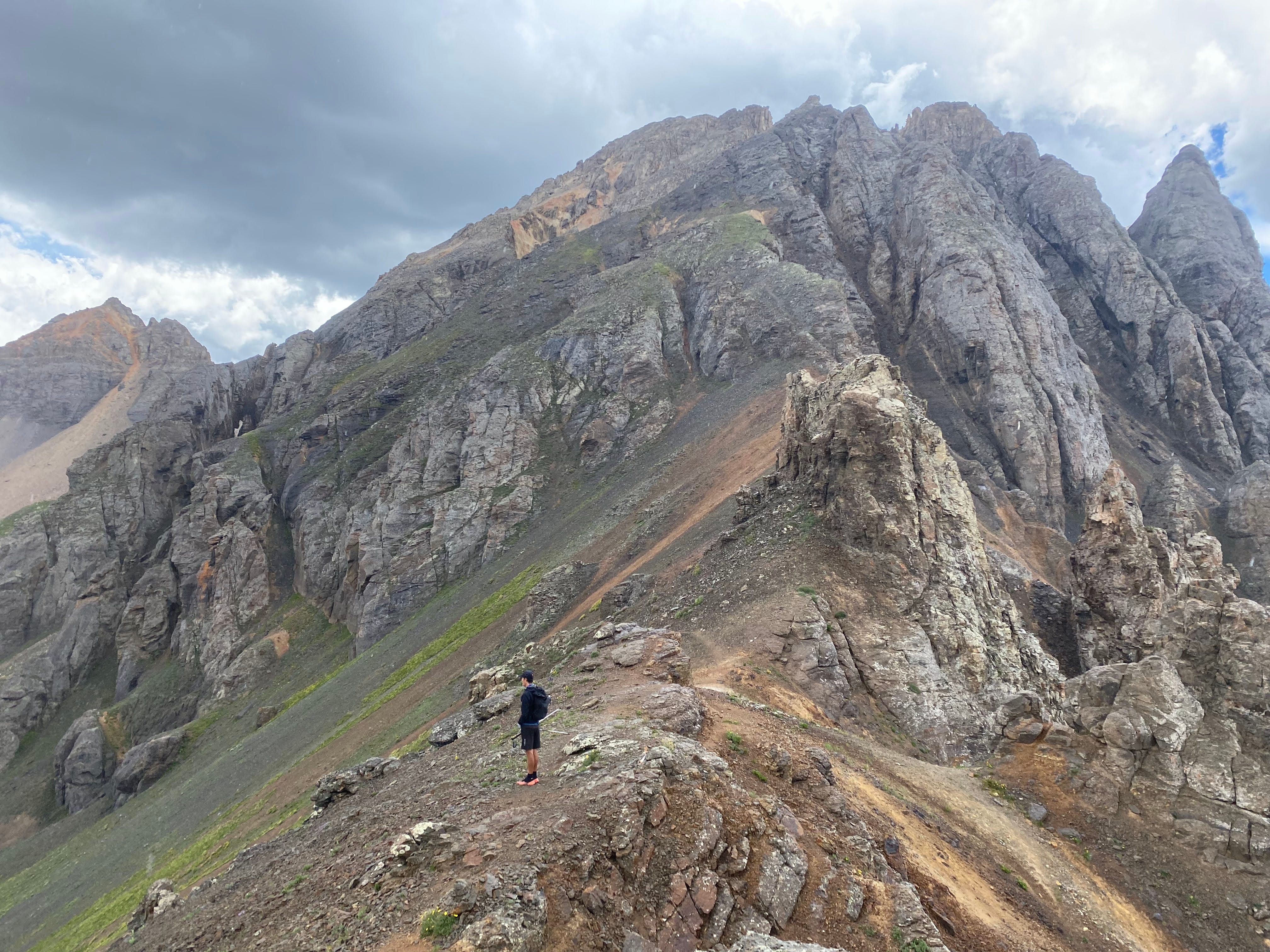
How do you get off this ridgeline? We struggled with route finding on numerous occasions.
If you’ve read this far, thank you, and here’s a few final tips for your Soft Rock adventure:
Camping around Silverton - if you want to boondock or camp around Silverton either before or after you run Soft Rock, you will have no problem doing so. There are a number of designated campgrounds if you prefer to have more facilities available such as bathrooms, water, dump stations and other amenities. If you’re like me and just want a free spot to camp, there are plenty of dispersed camping and boondocking opportunities on Forest Service roads all around the Silverton area (check out the iOverlander app). Of course, there are way more people around Silverton the week of Hardrock but we were still able to find some great spots to camp for the night.
Crew Support - my wife supported us by providing us with a resupply in Ouray but if you’re not able to arrange for support, you can buy food in both Telluride and Ouray which are the only towns that you’ll pass through other than Silverton which is the start/finish.
Going Clockwise or Counterclockwise - The Hardrock 100 course alternates going clockwise and counterclockwise from year to year. We ran the course clockwise as that was the direction of the race in 2022. We benefited from hitting both Telluride and Ouray in the first half of the course as they provided opportunities to resupply. On the flip side, that meant that we had no opportunities to resupply on the second half of the course and had to carry more food to get us through the final 55+ miles. That’s probably why we were totally out of food by the time we got back to Silverton!
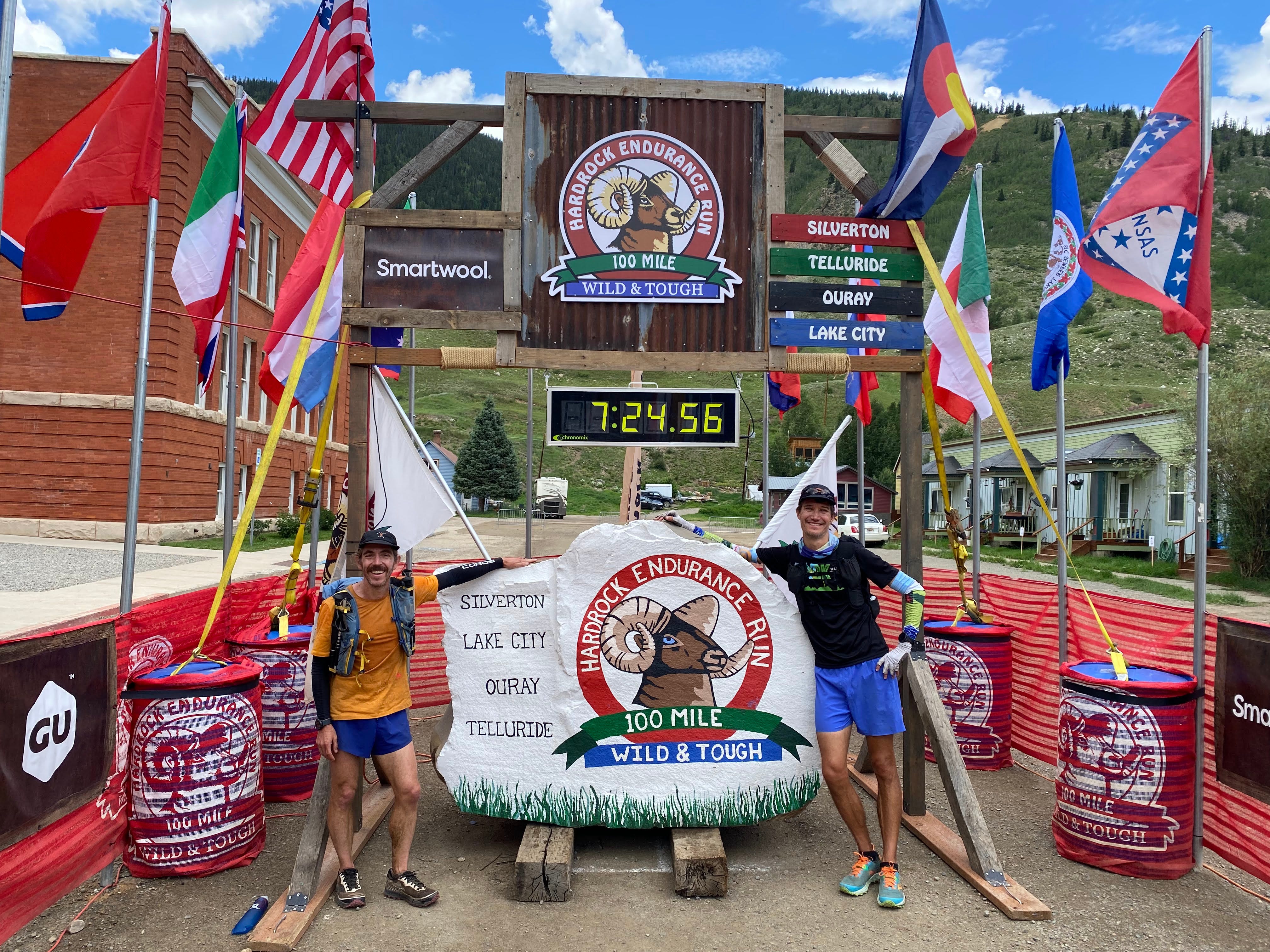
One other benefit of doing Soft Rock the week before the race is that you can ‘kiss the rock’ when you finish up your run in Silverton.
All photos by Richie Duchon.
I ran about 2 miles yesterday
Thanks for sharing. This brings back memories: I did a four day loop alone, but I didn't carry anything, I just stayed in the three towns along the way. (I started and ended in Sherman, which is one of the few places on the course, besides the three towns, that you can drive to in a regular car.) Your day #2 was a *monster* day: It's a day's effort just to go from Telluride to Ouray, but you tacked on the 5000 ft. climb over Engineers, then ran down to the next valley. Great job!